Trail Walking Le Vernet - Les Bois Dieux - Photo
© OpenStreetMap contributors
Length
Length
7.8 km
Max alt
Max alt
498 m
Uphill gradient
Uphill gradient
218 m
Km-Effort
Km-Effort  
10.7 km
Min alt
Min alt
349 m
Downhill gradient
Downhill gradient
219 m
Boucle
Boucle
Yes
Creation date :
2016-08-11 00:00:00.0
Updated on :
2016-08-11 00:00:00.0

(1 Reviews)

Walking
Walking
2h09
Difficulty : Medium

Scan this QR Code to open this trail in the SityTrail application

FREE GPS app for hiking

Logo SityTrail SityTrail

IGN / Geographical institutes

Download SityTrail from the App Store Download SityTrail from Google Play

Logo SityTrail SityTrail World

The world is yours!

Download SityTrail from the App Store Download SityTrail from Google Play Download SityTrail on Huawei AppGallery

About

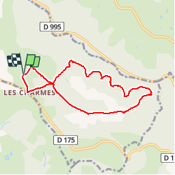
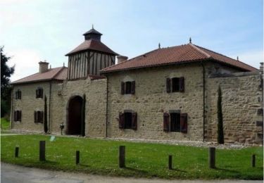
Trail Walking of 7.8 km to be discovered at Auvergne-Rhône-Alpes, Allier, Le Vernet. This trail is proposed by Geronimo2010.

Elevation profile

Positioning

Country:
France
Region :
Auvergne-Rhône-Alpes
Department/Province :
Allier
Municipality :
Le Vernet
Location:
Unknown
Start:(Dec)
Start:(UTM)
536700 ; 5105512 (31T) N.

Comments

Please log in to post a review or rate the element


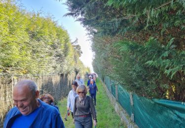
très belles randonnée. un conseil : suivez absolument le chemin indiqué. Les chemins de traverses sont encombrés de ronces. Gare aux tiques.


Trails nearby

Trail Running Bellerive-sur-Allier - jour 9 CAP Jeanot - Photo
Running
jeannat

Running

Very easy
Bellerive-sur-Allier, Auvergne-Rhône-Alpes, Allier, France
29 km | 33 km-effort
3h 5min
No
Trail Mountain bike Vichy - Rives et Boires de l'Allier - Photo
Mountain bike
tracegps

Mountain bike

Easy
(1)
Vichy, Auvergne-Rhône-Alpes, Allier, France
19.9 km | 21 km-effort
1h 45min
Yes
Trail Walking Le Vernet - Les 2 vallées: de l'Allier et du Sichon) - Photo
Walking
tracegps

Walking

Medium
(1)
Le Vernet, Auvergne-Rhône-Alpes, Allier, France
10.3 km | 13.1 km-effort
2h 30min
Yes
Trail Walking Vichy - Vichy - Photo
Walking
emileverschueren

Walking

Easy
Vichy, Auvergne-Rhône-Alpes, Allier, France
4 km | 4.2 km-effort
1h 58min
No
Trail Walking Le Vernet - Le Vernet - Photo
Walking
guy63

Walking

Medium
Le Vernet, Auvergne-Rhône-Alpes, Allier, France
7.2 km | 10.1 km-effort
2h 23min
Yes
Trail Walking Saint-Yorre - CLD - GM- Le 22-03-2022 - Photo
Walking
JackPG

Walking

Difficult
Saint-Yorre, Auvergne-Rhône-Alpes, Allier, France
11.4 km | 14.6 km-effort
3h 12min
Yes
Trail Walking Vichy - Vichy - Photo
Walking
guy63

Walking

Medium
Vichy, Auvergne-Rhône-Alpes, Allier, France
8.5 km | 9.2 km-effort
3h 40min
Yes
Trail Walking Vichy - vichy Historique  - Photo
Walking
guy63

Walking

Very easy
Vichy, Auvergne-Rhône-Alpes, Allier, France
7.7 km | 8.6 km-effort
2h 42min
Yes
Trail Walking Busset - Rando du château de Busset - Photo
Walking
tracegps

Walking

Medium
Busset, Auvergne-Rhône-Alpes, Allier, France
9.5 km | 13.4 km-effort
2h 0min
Yes


Close
My subscriptions